Chihuahua Desert Spring!

•April 5, 2010 • Leave a Comment

(Please click on any image to open an enlargement)

EL PASO, TEXAS.  Living in the Desert Southwest has its rewards.  Located in the middle of the Chihuahua Desert, wrapped around the southernmost promontory of the Rocky Mountains, El Paso, Texas boasts a diverse biome in a harsh landscape.  According to the World Wide Fund for Nature, the Chihuahua Desert may be “the most biologically diverse desert in the world“.  Springtime, after a wet winter such as we had in 2009-2010, brings out an amazing array of colorful blossoms!  The harbinger of a “good bloom” is the Mexican Poppy.  When the flanks of the Franklin Mountains begin to show an orange-yellow tinge in places, its time to grab the camera, hiking shoes, some water and head into the hills!

The red granite ramparts of North Franklin Peak and lush ground cover off of Transmountain Road in Northeast El Paso have drawn people to the slopes of the mountains for thousands of years.  Nestled in the shelter of the boulders, one might find an occasional petroglyph marking what could have been an ancient Native American hunt or camp area. Much this area is restricted to access because of its historical use as a firing range for the artillery and air defense training centers at Fort Bliss, at the foot of the Eastern flanks of Mount Franklin.  The military name for this 800+ acre No-Man’s Zone is Castner Range, and there is a grass roots effort to have the government clean up the shell and bomb debris and put it back into productive community use.

Careful there! The needle-sharp spikes of the Lechuguilla, or Spanish Dagger, one of the “indicator plants” of the Chihuahuan Desert

Morning sunlight catches the golden spines of the Prickly Pear cactus,                                                          while a colleague captures an image nearby.


Canyon de Chelly, the horseback trek!

•March 15, 2010 • Leave a Comment

COTTONWOOD CAMP, CHINLE, AZ    After a good night’s rest at the Thunderbird Lodge near the entrance to Canyon de Chelly, we headed to our Native American outfitter to check in for the adventure ahead of us. Thoughts of our week-long trek through the vast landscapes of Northern Arizona and New Mexico exploring ancient ruins and speculating on origins of North America’s first civilizations formed a backdrop to the sights, sounds and smells under the shade of the ancient Cottonwoods along the edge of the Chinle Wash.

Map of Northern New Mexico and Arizona: Chaco Canyon and Canyon de Chelly Country - Land of the  "Ancient Ones"!

Map of Northern New Mexico and Arizona: Chaco Canyon and Canyon de Chelly Country – Land of the “Ancient Ones”!

Canyon de Chelly Location Map

The day-long ride through Canyon de Chelly with our Navajo guide would be 19 miles or so, and take 7-8 hours.  That’s a long day in the saddle.  Getting to the start took a while.  The ride outfitter was experienced, and very busy, taking care of several different rides and a lot of riders out of a large barn and stable complex next to the Chinle Wash under the shade of huge Cottonwood trees.  Ours is the longest day ride they offer, and so we waited for the early riders to leave with their guides on shorter destinations, enjoying the flow of visitors and commotion.

Our mounts were eventually chosen for us and saddled up and we jumped into a super-cab truck with the horses in a trailer behind.  Off we went along the same rim road we had taken the day before, this time with our own Navajo guide for the trail ride and a driver, who would drop us off and take the truck and trailer back to the stables.  When the pavement turned into an unmaintained gravel and dirt road, we kept going for another five miles.  Passing stands of pinon pine and scrub oak amongst the grey sage ground cover, some Ponderosa pines visible on the edges of the canyon to our left, the drive was beautifully scenic as we arrived at the trailhead near the top of Bat Canyon.  There, we unloaded the horses, checked the cinches, downed some water and saddled up for a private guided ride through the Homeland of the Navajo Apache.

Multhauf starting the ride in the sage and pinon mesas above Bat Canyon

The steep descent through Bat Canyon required some care

…even to the extent of our guide walking us past some tricky spots!

Spider Rock, up close and personal….

INHL Team leaving Spider Rock for other discoveries….

A running stream washes through the entire canyon bottom

Ancient petroglyphs on the canyon walls

The most famous pueblo ruin in the canyon is called White House, seen earlier from the Tseyi Overlook, but now looming large in front of us as we wind along the trail next to the stream in the canyon bottom.  Our guide invites us to dismount for a rest and a short lecture as we take in the awesome location the Ancient Ones chose for this protected retreat built into a cliff face!

Our Navajo guide explains the significance of the White House Pueblo ruins…

Messages left from the past…

Finally, nearing the trail’s end in the Chinle Wash of Canyon de Chelly…

…a long, hard, beautiful ride!

Route of the all-day horseback ride through Canyon de Chelly, a tough 19-mile adventure of a lifetime!

Route of the all-day horseback ride through Canyon de Chelly, a tough 19-mile adventure of a lifetime!

The muscles in our legs, thighs, butts and backs were cramping and screaming loudly after our eight-hour marathon trail ride through the Canyon.  A hot shower and some good pain killers washed down with some cold beer successfully muted most of the complaints about the expedition, and left us in an exhilarated mindset for the full lunar eclipse later that night, a Blood Moon:

Gazing at the orange globe hanging in that black Southwestern sky, it was hard not to imagine predecessors of ours in this place, descendants of the Athabaskan peoples of Northern Canada and Alaska who later were known as the Ancient Ones-the Anasazi, also gazing in wonder at the moon and stars and trying to place themselves in the scheme of such cosmic things….

INHL Logo Globe Grey-Preserving the Past

Canyon de Chelly, Heartland of the Apache!

•March 14, 2010 • 2 Comments

CHINLE, ARIZONA – There are only certain prescribed ways that you can see Canyon de Chelly, all have to do with Native American guides who must accompany you into the National Monument.  It is the only National Park site that resides exclusively on Indian Reservation land, therefore the National Park Service only “administers” the area, the Canyon is operated by the Navajo Apache Nation.  You can walk or mountain bike into the Canyon, take jeep and ATV tours through the wet river gorge, and even ride horseback…all just up the road from the town of Chinle, Arizona at the entrance to the Monument…but you must hire a local, Native American guide or tour company to do so. The Thunderbird Lodge is your best bet for a base in the area.

Canyon De Chelly - Chaco Canyon Map

Map of Northern New Mexico and Arizona: Canyon de Chelly and Chaco Canyon, where the “Ancient Ones” lived!

You get there on US 191 north from Interstate 40, or the same road south from the Four Corners area where Colorado, New Mexico, Arizona and Utah all meet.  We came in from the north and the beautiful Four Corners tour that includes Monument Valley after our stay at Chaco Canyon in New Mexico, with Shiprock and other scenic vistas along the way marking our path.

The 17-mile long overlook drive along the edge of the canyon rim, once we got to Chinle and the Cottonwood Campground next to the Thunderbird Lodge, gave us inspiration for the next day’s adventure.  From the town, the paved drive heads southeast up the canyon rim to Cottonwood Junction Lookout, then Tseyi Overlook, Sliding Rock Overlook, and finally Spider Rock Overlook.  I venture to say that most visitors only see this much of the Canyon, but if this is all you see…it’s still gorgeous!

INHL Director Jim Davison at the Cottonwood Junction Overlook

White House Pueblo ruins seen from the Tseyi Overlook

Cross-bedded sandstone from wind-blown dunes eons ago, from the Sliding Rock Overlook.

Spider Rock, seen from overlook of the same name.

This is where the Navajo Apaches came from, where their fathers, and great-grandfather’s of great-grandfathers lived.  It is a unique, narrow, verdent,  green valley hidden in the vastness of the Southwestern High Desert.  From the top of the mesas, the streams feeding the trees and grassy meadows transfix your vision.  The stark difference between the protected and sheltered valley and the wind-swept high mesas was remarkable.  Little wonder the Apaches retreated here millennia ago.  The name “Chelly” is a French-like pronunciation spelling of the Spanish derivative of the original Navajo word for the canyon: Tseyi, meaning “inside the rock”.   This Canyon, this Navajo Heartland, was definitely “inside the rock”!

Maybe the Navajo Apache connection to the Ancient Ones who built Chaco isn’t so far fetched an idea as it first sounded!  Retreating here after their culture began to breakdown in Chaco would be a natural reaction.  We’ll certainly know more after tomorrow’s horseback trek for nine hours through 19 miles of this secret Canyon!

Chaco, the Regional Hub

•March 13, 2010 • Leave a Comment

CHACO CULTURE NATIONAL HISTORIC PARK, NEW MEXICO – Preparing to leave Chaco and move on to explore another nearby Native American site at Canyon de Chelly, Arizona, our INHL Team discusses the connections between Chaco and other regional centers of population and trade.  It was said that the timbers used in the construction of the pueblos at Chaco were brought from hundreds of miles away.  Thousands, maybe hundreds of thousands, of timbers were needed in the multi-story architecture laid out all over Chaco Canyon.  The developmental level needed to create and support a “Chaco”, in terms of not just physical construction but societal, painted a portrait more complex than we expected.  These vigas were one clue pointing us in the direction of answers, we hoped.

Beam and floor planks still in place at Chaco Canyon after 1,000 years!

Indeed, the nearest conifer forests are at least 60-70 miles distant.  Sea shells and colorful bird feathers were found in the course of excavating the ruins here.  However, the nearest ocean is hundreds and hundreds of miles away:  the Pacific at the Southern California Coast (600 miles West), or the Gulf of California between Baja and Mexico (500 miles Southwest), and the Gulf of Mexico (1,100 miles Southeast). Exotic pottery, shells, bird feathers and imported lumber all add up to a network of trade and travel connections indicating at least a Regional Hub and a probably a Spiritual Pilgrimage site out of the pueblos of Chaco Canyon over time.

The Regional Linkages with Chaco Canyon


Map of Northern New Mexico and Arizona: Chaco Canyon and Canyon de Chelly Country - Land of the "Ancient Ones"!

Map of Northern New Mexico and Arizona: Chaco Canyon and Canyon de Chelly Country – Land of the “Ancient Ones”!


Heading out of Chaco Canyon towards our next destination: Canyon de Chelly!

If we were able to travel the prehistoric road directly west out of Pueblo Bonito, about 90 miles as the crow flies, up and over the Chuska Mountains (on the border of Arizona and New Mexico) sprawls the three-canyon National Monument commonly referred to as “Canyon de Chelly”, our next destination.  No straight-as-an-arrow path was available for us today, though, for we must follow our modern road system which take us on a wide arcing route through the Four Corners area of Northwest New Mexico and Northeast Arizona, and then south by southwest through vast landscapes.  This is true “Indian Country” with towns named Yah-Ta-Hey and Fort Defiance, Window Rock, Navajo and Zuni.  Just up-canyon from the town of Chinle, Arizona and outside the main entrance to the Canyon, we settle into the Cottonwood Campground next to the Thunderbird Lodge (with a restaurant and bar!) unhitch the trailer and go for a drive to see tomorrow’s horseback trek destination:  Canyon de Chelly.

Canyon de Chelly overlook near Chinle

Multhauf over-looking Canyon de Chelly

Spider Rock, one of our destinations on our Canyon de Chelly horseback trek.

The Secret of the Anasazi!

•March 10, 2010 • 2 Comments

EL PASO, TEXAS – In May of 2003, the INHL team gathered in El Paso to begin another expedition in search of truth.  This time, to discover what was behind unanswered questions surrounding the archaic cultures who left us two incredible archeological sites in New Mexico and Arizona: Chaco Canyon and Canyon de Chelly!  It is said that these sites held keys to the development, and eventual disappearance, of one of the mystery cultures of North America: the Anasazi, or Ancient Ones!

Map of Northern New Mexico and Arizona: Chaco Canyon and Canyon de Chelly Country - Land of the "Ancient Ones"!

Map of Northern New Mexico and Arizona: Chaco Canyon and Canyon de Chelly Country – Land of the “Ancient Ones”!

Leaving West El Paso in the Suburban, camper trailer in tow, the founding members of the International Natural History League (James Davison, Chris Multhauf, and Dave Etzold) head north on Interstate 25 to Albuquerque, and then northwest at Bernalillo on State Highway 44…into “Indian Country”.  As we drive deeper into this vast desert landscape, exotic and surreal horizons unfold out our windows.  Cruising in the Suburban, stereo pumping out cool vibes through a visual fairy land …nice…

Exotic New Mexico desert landscape, northwest of Albuquerque

Shiprock rising from a strange alien plain

Turning off the paved highway toward the Chaco Canyon UNESCO World Heritage Site, we are stunned to find that we face a jarring 20-something mile ride over a washboard dirt road to the entrance of the National Park!  Mile after mile of bumpy, dusty, rutted desert road seemed almost like a purposeful barricade left in place to shelter this sensitive historical site from a potential crush of visitors. We are, after all, on the Eastern edge of the Navajo Apache Indian Reservation!  On and on, we slowly maneuvered the SUV and barely attached trailer through the stark terrain, until finally:

Entrance Statement to Chaco Canyon

….and the campsite nearby, against a beautiful cliff face…covered with ancient pictographs!

INHL Basecamp at Chaco Canyon

Now, for a walk to stretch our legs in the late afternoon sun…nearby, a Historical Marker describing Fajada Butte in the distance.  Starkly illuminated by the low-angled sun, the Butte stands out as a significant feature in the valley that we will be exploring during the next few days.  Interestingly, the Marker describes a deeper significance to the Butte than just its stark appearance: there exists a unique astronomical instrument on top of Fajada Butte, which marks the solstice and equinox moments of the sun!

Fajada Butte, golden in the evening rays of the sun!

Historical Marker describing the solar astronomical instrument built by the Chacoan Culture             on top of Fajada Butte!

Now, this was right up our alley!  Right away, we are delving into the underlying significance of this culture and this place!  The INHL has surely found its stride, as it were, on this particular expedition.  There is an interesting connection here with other Meso-American civilizations in the recognition of the power of the sun, and how to mark and even predict the significant solar events of the calendar.  Years later, we would discover similar solar tracking devices and spiral images in Peru: in the Nazca lines and in Inca ruins on the Inca Trail Trek to Machu Picchu!  For now, though, it was up to us to seek answers to the questions posed about these particular ruins, and the people that built them…The Old Ones…the Anasazi!  To do that, we would need some sleep and a fresh start in the morning.

Other campers, in tents, under the warm glow of the Chaco cliffs

National Geographic Society & Smithsonian Institution plaque at Chaco Canyon commemorating seven expeditions to the site from 1920 to 1927.

Chaco Canyon, the valley laid out below us, and the Pueblo Bonito ruins

Multhauf and Davison on our early morning exploration

Pueblo Bonito ruins and cliffs above

Huge ceremonial kiva…

Multhauf illustrating the scale of the doorways

Ancient 1,000-year old vigas and fine stonework…

Windows with strategic views…

So, we decided to follow a trail up the cliffs above the ruins for a perspective on this incredible, serene and isolated city the Chaco built so long ago!   From there, the views and fresh breeze inspired us to wonder about the disappearance of this, and so many other native American cultures.  Was it drought…or, disease….or, war…or, famine?  Why abandon these beautiful homes and ceremonial buildings to the sands of time?  We are drawn deeper into the mystery with every step.

Multhauf pointing the way carefully up the cliffs above Pueblo Bonito

Davison squeezing through a well-worn Chacoan trail to the top…

Another way to the top! The “Jackson Stairs”….better left to the Indians.

View of cliffs that collapsed hundreds of years ago on a portion of Pueblo Bonito!

Metate used by women grinding seeds and grain, and a Collared Lizard on a rock!

Large Bull Snake along the trail!

…a fitting close to this chapter in the search for answers to questions surrounding these cultures!  Next stop…Canyon de Chelle!

Map of the Chaco Culture World Heritage Site

Yea, Sewanee’s Right!

•March 8, 2010 • 1 Comment

Here’s how it went in August 1972:

The bus pulled away late in the afternoon after a long ride through the Middle Tennessee countryside from downtown Nashville.  I was standing there on University Avenue, madras-plaid-jacket-button-down-shirt-and-khakis clad, alone in the sticky late Summer heat with my two large footlockers that the driver had dragged out of the luggage hold.  The Quadrangle and All Saint’s Chapel were at my back, and I had no idea how to get where I needed to be in order to find my dormitory and get settled in my new home for the next four years: The University of the South in Sewanee, Tennessee!

All Saint's Chapel, anchoring the Quadrangle

Walsh-Ellett Hall overlooking the Quadrangle.

The flight from El Paso to Nashville was eventful enough to leave no memory, at least none after 38 years.  However, the search for the bus station, after the taxi from the airport left me off a few blocks away in the old warehouse district near the Ryman Auditorium, was a bit edgy…with the grit and poverty of a pre-boom-town-Nashville starkly evident.

So, here I was!  Sewanee…looking like it was transplanted from Oxford England!  The smell of the gurgling exhaust from the bus drifted away and was quickly replaced by that wet, musty “deciduous forest smell” that I had never experienced in my life in the deserts of the Southwest!  Pine and pinon forests smell different, and the desert after a summer rain storm has the sweetest, freshest smell of anything nature deals out!  This was completely different.  My first deep breaths of those moist Southern forests had an aged quality, a richness…and a depth…a texture!  They say that smells are the most primitive and ancient of our senses, maybe even connected to our strongest memories.  One thing for sure, I will never forget that smell of the Cumberland Forest wrapping me in its insidious texture that late afternoon.  It is a sensory stimulant I look forward to whenever I visit East of the Mississippi, a memory-experience etched deeply in my mind.

Sewanee-Rendered Map of campus

Shaking off the spirit of the moment, I had work to do: find the Registrar’s Office and get directions to my dorm (and hopefully some help with these damn trunks!)  John Ransom’s Office (The University Registrar) was, then, in an old stone building topped with a weathered copper-green observatory dome, right in the middle of the “U”-shaped Quadrangle: Carnegie Hall.  Yes, even here in the middle of the Middle Tennessee woods, that family had made it’s mark!  The secretaries helped get me someone to drive me down to what was called “New College” dormitory, now Trezvant Hall by Lake Finney.  It was a long way from the center of campus, and I was glad that I didn’t have to move those trunks myself!

Weeks later, my parents would ship me a ten-speed bike, which became my favorite form of transportation and exercise.  According to University rules, freshmen could not have cars.  But, I had no misconceptions about this, it was enough that mom and dad could send me to Sewanee without pushing for a car to boot!  That bicycle and I spent hours and hours together: between the dorm and classes, of course, but just exploring the immense University Domain was an adventure!  That will take up some of the rest of these posts….

The road to Morgan's Steep

Inca Trail Trek, the Photo Gallery

•February 19, 2010 • 11 Comments

(You can pull up a larger-sized photograph by simply clicking on a photo.)

February 19, 2010 EL PASO, TEXAS.  One month ago, an expedition from the INHL was in the midst of an adventure in Peru on the Inca Trail which still resonates strongly inside of me.  There is hardly an hour that goes by without a memory of that trip echoing in my mind!  I can’t get it out of my head!  Photographs convey a much deeper message than words ever could.  To that end, one of our INHL team, Chris Multhauf from Chicago, recently put together a short slideshow set to incredible original music by a friend of his, Doc Severinsen, which captures the thrill and inspiration of this expedition:

CLICK HERE, to open a new window and enjoy this well crafted slideshow, and turn up the volume to enjoy the original soundtrack by a friend of the INHL:   http://animoto.com/play/T0s21v181lCBqUkvCwyBDg

Back in the blog, I present a gallery of some of my favorite photographs (most, as yet, unpublished) which also help capture the essence of this incredible journey:

Lobby of the Miraflores Park Hotel, Lima

Lobby of the Hotel Monasterio, Cuzco

Cuzco Cathedral and Plaza

Altar in the underground Crypt of the Iglesia de la Compania de Jesus, Plaza de Armas, Cuzco

Dinner in the “Glass Box” at the Museo de Arte Precolumbino (MAP Cafe), Cuzco

Hatunrumiyoc street, Cuzco

King James at Saqsaywaman

Old friends…at Saqsaywaman ruins above Cuzco.

Multhauf and Etzold enjoying some roadside corn-on-the-cob and cheese on the way back to the hotel from Saqsaywaman.

Ollataytambo Town Center, on the way to the Kilometer 82 starting point.

“Kilometer 82” official checkpoint for the start of the Inca Trail!

Rock faces covered with bromeliads along the Inca Trail

Our guide from Llama Path, Julian Perez, and some beautiful hallucinogenic flowers!

“Red Army” from Llama Path on the Inca Trail

Davison and Multhauf at Wayllabamba Camp

Soccer game at Wallyabamba. Peru...at 10,000 feet above sea level...on the Inca Trail Trek in 2010.

High altitude soccer game at Wayllabamba. Peru…10,000 feet above sea level…on the Inca Trail Trek to Machu Picchu.

Wayllabamba Camp and Mount Veronica in distance, end of Day One on the Inca Trail

My own “Wishing Rock” (the light grey, dry stone in right lower center) placed on this flat stone at the top of Warmiwanusca Pass (Dead Woman’s Pass) as a totem and prayer rock among so many others.

The INHL Team of Etzold, Multhauf and Davison at the summit (13,779 feet) of Deadwoman’s Pass in a driving cold rain storm!

Pacaymayu Camp in the mist below, after crossing Dead Woman’s Pass. Runkuraqay Pass in the distance with trail segment for Day Three tracing up the far side of the valley.

Sayacmarca ruins in the rain and fog, just past the Runkuraqay Pass.

Multhauf late in the afternoon on day three, above the Urubamba River canyon, nearing our final camp at Winay Wayna.

Machu Picchu from the Sun Gate (Intipunku) just before sunrise January 23, 2010.

Early morning fog breaks in the rising sun over Machu Picchu.

Main Plaza, central terraces and view of cloud covered Machu Picchu Mountain

Multhauf, Etzold and our guide from Llama Path Julian Perez at the Intihuatana Stone, the famous “Hitching Post of the Sun”.

Central Plaza and Huayna Picchu

Detail of Huayna Picchu and the Temple of the Moon

Principal Temple with the pyramid and Intihuatana above and in the background.

On our way out of Machu Picchu, and down the mountain to Aguas Calientes.

The raging, flood-level Urubamba River running next to the town of Aguas Calientes before we try to leave on the train to Cuzco.

As you’ll read in earlier posts, we had a harrowing afternoon and night trying to get out of Aguas Calientes on the train.  The river had flooded the tracks throughout the Sacred Valley and our planned relaxing dinner ride on the famous Hiram Bingham Train to Cuzco was replaced by an emergency evacuation from the village!  The whole event made international news, and we barely made it back to Cuzco…read more in the post entitled “Dunkirk on the Urubamba“.

Urubamba River past “flood stage” raging next to the damaged train tracks!

Damage along the “river walk” in Aguas Calientes a few days after the INHL Team escapes!

-Vinci!

INHL Logo Globe Grey-Preserving the Past

Reflections on the Inca Trail

•February 4, 2010 • 2 Comments

February 3, 2010 EL PASO, TEXAS.  Trying to record a summary of memories of our recent INHL Inca Trail Adventure to Peru is as difficult as holding onto a reflection in a clear pool of water.  You try to reach for the image, and the reflection scatters into a million scintillating ripples of thoughts and impressions.  A tome comes to mind which I reflected upon at the beginning of this adventure:

“It is only by thinking about great and good things

that we come to love them,

and it is only by loving them

that we come to long for them,

and it is only by longing for them

that we are impelled to seek after them;

and it is only by seeking after them

that they become ours.”

–Henry Van Dyke


THE INCA TRAIL:  An awesome physical and spiritual experience.  

The physical side: 45 Kilometers from the start at the Kilometer 82 Checkpoint to the end at Machu Picchu.  Nine measurable ascents and descents: 6,716 feet of total ascent (3,937 feet the greatest single-day ascent), versus 7,766 feet of total descent (3,281 feet the greatest single-day descent).  Highest point: 13,779 feet (4,200 meters) at Warmiwanusca Pass.  Three camp sites, four days of hiking anywhere from 12-18 kilometers per day.  It is advised that you buy and use a bag of coca leaves to chew and use in your tea!  Seven significant Inca ruins lie along the trail, a warm up before arriving at Machu Picchu!  150-170 trekkers (plus porters and guides) are allowed to start the trek each day, who become your fellow pilgrims on this journey through the Andes Mountains. Arrival at Intipuku before sunrise is dependent on leaving Winay Wayna just as the checkpoint opens at 5:30am and really pushing the hike to the Sun Gate.  Once you get there, be patient, you will have plenty of time to tour the ruins of Machu Picchu and still make it down the mountain to Aguas Calientes for the train ride back to Cuzco.  It’s a grand vista from the Sun Gate, and a beautiful easy walk down to Machu Picchu.

The spiritual side: The Peruvian people are sweet and gentle.  Their spirit imbues the trek with a sense of peace, in spite of the physical challenges.  Smile at them and they smile back.  Test your Spanish, they’ll try to communicate.  The food prepared by our Llama Path chef was superb, and used so many native ingredients that I felt we were eating as Incas while walking their highway.  The flowers (orchids, bromeliads, etc) we saw in our summer-time trek were amazing.  The waterfalls cascading down from the high peaks were gorgeous.  The rain (for an old desert rat) was beautiful and made everything so fresh and green.

I will do the Inca Trail again in a few years, with my son Liam, God willing!  He’s only 14 now…give him two or three more years and we’ll be back!

View of the Cathedral and rooftops of Cuzco

CUZCO:  A gorgeous gem of a city, high in the Andes.  I could have spent weeks just in Cuzco and the surrounding countryside!  From the cobblestone streets lined with ancient Incan stone foundations, to the red tiled roofs and brilliant blue sky, this city that was the capitol of the Inca Empire deserves time to explore.  Our hotel (the Monasterio Hotel) was a monastery in the 1600’s and is beautifully appointed and managed.  One of the finest restaurants in Cuzco is right in the hotel.  But, nearby are many other choices for either housing or eating…the city is compact and well designed for visitors.  Get out and walk it!  For nightlife lovers, the parties went on until early morning.  For shoppers, the markets and shops were seemingly endless.  Flights into and out of Cuzco are limited to the early day, due to thunderstorm danger in the afternoon and evening.  We had a serious four or five hour delay trying to get back to Lima.  Remember, it’s Latin America, roll with the flow.

If you are doing the Inca Trail, get there three days early to acclimate.  Be sure to enjoy the coca leaf tea offered at your hotel and most restaurants…it helps.  Many trek outfitters and tour operators can be found in the city, we had found Llama Path (www.llamapath.com) on the Internet months earlier and booked our place on the trek well before we left.  Everywhere we went on the Internet researching the trek, we found high praise for Llama Path.  Now that we have actually experienced their service, I can’t imagine using anyone else or recommending another outfitter!  Their “Imperial Service”, which is a private group trek-not their large group of 15-16 hikers, was $765 per person.  The extra couple of hundred dollars per person for the private group was well worth the investment.

Cuzco main square from Saqsaywaman

The South Pacific Ocean from the cliffs of Miraflores in Lima, Peru!

LIMA:  This gigantic Latin American capitol city sprawls against the South Pacific Ocean, where the best neighborhoods to visit and stay are located: Miraflores, Barranco, and San Isidro.  Most people just travel through Lima on their way to Cuzco or some other South American destination.  It deserves a couple of days of your time.

If you’ve seen other large Latin American cities, this one will seem familiar and won’t shock you.  If you’re used to Europe or North America, well… grit your teeth.  Here’s what you do: find a good hotel (we stayed at the Miraflores Park Hotel), and trust them to get you a good taxi driver.  Pay him to take you on a day-tour:  Plaza de Armas, the Cathedral (with Francisco Pizzaro’s tomb), the San Francisco Monastery and Catacombs, the Huaca Pucllana ruins, the Larco Museum (with it’s superb restaurant and courtyard bar)…and the Larco Mar Shopping Center overlooking the ocean from the cliffs in front of the J W Marriott Hotel and Casino in the Miraflores district.  That’s all you need.  Don’t drink the water, eat raw seafood or use ice in your drinks!

Larco Museum

Larco Museum restaurant and bar in a beautiful courtyard!

The Larco Mar Shopping Center, built into the cliffs overlooking the South Pacific Ocean!

…Fini!

Inca Trail, Day Four: Machu Picchu!

•January 30, 2010 • 3 Comments

(You may click on any photograph to pull up a larger version of the image.)


Saturday, January 23, 2010  WINAY WAYNA CAMP, PERU. The music played in the Hostel at Camp Winay Wayna until exactly 10:15pm when the sounds of the night frogs and crickets returned to the high jungle.  The bottles of empty Cusquena and Cristal beer scattered around the patios outside early the next morning spoke volumes about the party that had gone on after we retired from the hot showers the night before.  It had been fun, once we arrived and changed out of our trail clothes, to mingle for an hour or so with the rest of our band of 150-odd trekkers at the multi-use concrete building that housed the kitchen for a restaurant, a bar area and serve-yourself coolers of beer, several sets of restrooms, hot showers, and a small store.  They said it was owned by an Italian, and I must hand it to whoever operated it…they not only have a captive market, but a thriving business!  This was our own “Inn at Canterbury” on the final night before the pilgrimage ended.  Here, we could trade stories with the people we had met on this incredible journey, and watch as the connections and interactions made settled into a remarkable celebration.

There was Cyril, the South African rugby player traveling with his cousin Lynn: who had lost his camera case and the memory card stored there – containing all his travel images for the past several months – on the first morning of the trek as they left the Kilometer 82 checkpoint.  He came through our Pacaymayu Campsite the other day with a couple of his porters asking every trekker and every porter if they had happened to pick up that case on the first morning.  Now, the smile on his face and sparkle in his eyes told us, before we asked, that he was successful.   A porter had actually picked it up the same morning he lost it!  Here was a real life example of one of the Inca three-way steps: Don’t Steal, Don’t Kill, Don’t be Lazy.

Then, Francesca and Company, the group of young British girlfriends on Holiday from school and very much the attention of most of the young men on the trek, enjoying their cigarettes even on the grueling climb over Dead Woman’s Pass!  They all seemed fairly unprepared with equipment and clothing for this trek, but managed to be there in the thick of that evening’s celebrations at the end of the trek with no apparent harm done.

Our trusty guide, Julian, and Chris remarking about Francesca and Company at a break at Llulluchapampa on the hike up Dead Woman’s Pass

Then, Toby from Sydney, the red-haired young vagabond who seemed to have joined the pilgrimage as an afterthought, or maybe on a dare during a night of drinking in Cuzco.  His blue tights (now getting a little baggy) always falling off his rear end to reveal his bright yellow undershorts, the plastic “grocery bag” of belongings carried in one hand and his sleeping bag and mat over his shoulder…stumbling up and over Warmiwanusca Pass with a dazed look on his face, admitting his delirium as he descended in the driving rain on the back side.  There he was, laughing and joking it up, beer in hand, playing a card game with several of the other young people…and sitting next to his new “best friend”, the famous Flip Flop Man.

Our first visit with Toby from Sydney on the way up to Warmiwanusca Pass

Yes, the Flip Flop Man: he presented a remarkable visage, tall and strong in a lean way, long brown hair rolled into a tight little bun on the top of his head, always a few day’s beard growth for that edgy look, long-sleeved knit shirts and only shorts…with his signature cheap flip flops!  Yes, he actually walked the entire Inca Trail in flip flops!  I can’t imagine a manlier thing to do…the women must have just thought he was a god, or something the way he strode those trails, sometimes actually jogging along the route!  The ever-present back-splash of mud drops on his calves and feet were a mark of highest manhood.  I must hand it to him, it was a most impressive performance!  Here, this final night, midst his covey of admirers, it was obvious the rewards were in hand, as it were…and his tent, we noticed, was just a few steps away from the Hostel, how convenient!

Toby and Flip Flop Man in the afternoon sun at Machu Picchu waiting for a bus to Aguas Calientes

Or, Malina the Doctoral Candidate, from Los Angeles who had just been to her 10th High School Reunion and is working on her PhD in Italian Literature.  She really appreciated the comments we made about our dinner at the Comedio Divino Restaurant in Cuzco, up the street one block from our hotel, where the staff entertained with live classical piano and beautiful arias selected from classic opera!  Her band of friends on the trip, some young men who looked much younger than she, never said a word to us or anyone else that we could tell on the journey.

 Davison and Multhauf interviewing Malina the Doctoral Candidate at Phuyupatamarca

And, then there were the two American newlyweds, Chuck and Wife 2, who we met on the third day of the trek climbing up Runkuraqay Pass. Before that, we three thought we were the oldest hikers on this trek.  When we met Chuck, who is from Denver, and his new wife of one week (they were on their honeymoon) we found that he beat us quite nicely!  Chuck turned out to be a healthy 60 years old, and his wife 51 years!  Here’s to Chuck and Wife 2!

Chuck and Wife 2, newlyweds from Denver, saying goodbye to us at the main gate to Machu Picchu…with the Sanctuary Lodge in the background.

I wish I could remember them all.  Moreover, I wish my camera hadn’t been damaged in the slippery wet drop inside the second Inca Tunnel the day before.  Else, I could have snapped a few photos of these new friends during the party that night on the deck overlooking the Urubamba River far below!  Suffice that those faces are embedded on the emulsion plate of my mind – the smiles and back-slaps that evening resonating in my memory for years to come.

At our camp that night after a final incredible dinner by our Llama Path Chef Cecilio, seated around the mess tent, lanterns casting sharp shadows on the tent walls, we had a simple ceremony where each of us presented the porters and chef with a bonus or tip for their services.  Each of us stood and gave little speeches in the best Spanish we could muster, complementing them each individually and praising Llama Path for this incredible journey.  I brought out my flask of Drambuie, purposely saved for a special occasion, and treated the three of us and our guide Julian to a couple of finger’s-worth of that golden nectar!  I don’t think Julian had ever had Drambuie before, but he sure finished his glass!

The early wake-up call, at 3:30am the next morning to get to the final checkpoint for our entry to the final leg of the trail to Machu Picchu, made for an early evening.  The last of the music was echoing away in the hills and the sleeping bag felt nice, as I thought about all that it had taken to be here, at this moment…and what we’d been through since arriving in-country on the 15th.  What an adventure! Now, the big reward, our final goal, was only hours away!  It was hard to fall asleep, even though a hot shower, a couple of beers and a long day of hiking were behind me…

I woke up a few hours later, before the wake up call, as usual. My body clock wouldn’t let this morning be wasted in a tent. The plan was to get dressed and pack up, have a final special breakfast (where Cecilio, this time, had baked a beautiful cake for us!) and then head down to the official checkpoint to get in line for the last section of the trail: to the “Sun Gate” Intipunku for the sunrise over Machu Picchu!  The morning was black, but there was no rain thank goodness, and that one point was a real encouragement.  We donned our headlamps, grabbed our trek poles and followed Julian out our camp and down the trail to the Official Checkpoint which wouldn’t open until 5:30am…it was now about 4:30am.

One group of about fifteen hikers was ahead of us in line when we got to the checkpoint a few minutes later.  As we had walked through the Winay Wayna Camp other groups were stirring, but our compact group was more efficient than a large group at getting started in the mornings.  No rain, and the sky was growing brighter above the jagged mountain range ahead of us as dawn approached.   We could now make out the profile  and contour of the mountains we had seen the day before, across the Urubamba River rushing far below.  Oh, for a clear day!

Machu Picchu Mountain in the distance as dawn breaks, Day Four!

Passport Stamp (page 11, red) for Winay Wayna Checkpoint on the Inca Trail

Pasports stamped, tickets stamped and we’re through the final gate, striking out at a fast pace, with legs that felt stronger and lungs more acclimated than ever.  The adrenaline (and maybe coca leaf tea) added a little surge to our steps, as well.  Here we go…

As the light improves, approaching the “Monkey Stairs” to the Sun Gate…

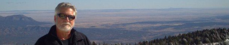
Julian, Davison and Etzold at the final stop before surise from the Sun Gate!

View of Machu Picchu before sunrise from the Sun Gate (Intipunku)

Multhauf and Etzold at the Sun Gate high above Machu Picchu!

Now, we’d have a nice gentle down-hill walk to our final destination, with skies now finally clearing (miraculously!) and our hearts singing I quietly gave thanks to God that we’d made it here for this moment…this perfect instant of time!  Woooowww!

View from the trail down into the Urubamba Valley, and the village of Aguas Calientes far below….

Llamas browsing along the trail into Machu Pichu from the Sun Gate, with the Hut of the Caretaker of the Funerary Rock in the background…

The INHL Inca Trail 2010 Team of Davison, Etzold and Multhauf arrive at Machu Picchu!

Royal Fountain….

…and details of water course…

Temple of the Sun

“Royal Tomb” under the Temple of the Sun

The “Enigmatic Window” on the north side of Temple of the Sun, and distant mountains…

Carved and polished sacred rock at Fountain 3, the Sacred Fountain

Corner of what Hiram Bingham called, “the most beautiful wall in America”…

Detail of the “most beautiful wall”…..

Amazingly precise and beautifully laid courses in the “most beautiful wall”…

Temple of the Three Windows at the Sacred Plaza

Carved stone in the shape of the Inca Cross, or mountains, in the Temple of the Three WIndows

The Intiwatana stone, the “Hitching Post of the Sun” at the top of the pyramid

The Intiwatana might be the most famous stone at Machu Picchu, if not in Peru, for it is the only surviving “Hitching Post of the Sun”…and barely that!  The Spanish conquerors destroyed all of the others that they found, but since this place was lost to them, this stone survived…until a few years ago!  In one unbelievable accident which happened during the filming of a Cusquena beer commercial, a TV crew lost control of a crane that smashed into the top corner of the sacred rock, chipping off a big chunk…the missing corner can be seen today if you look carefully (right in the center of the above picture)!!  Take care as you enjoy the walk through these ancient ruins.

View of main Plaza and Huayna Picchu

Here, around midday, we took a break and lay out in the sun on the grassy lawn of the lower portion of the Main Plaza.  It had been a long day, since arising at 3:00am to get to the Sun Gate!  Many of our fellow pilgrims from the Inca Trail trek ended up doing the same thing…the bright sun felt so good for a change!

Later, walking up to another section of the ruins, we run into a couple we recognized from the Hotel Monasterio in Cuzco, he was hard to miss with his long, blond ponytail.  We visited with them about our adventure on the trail, the challenges of the trek…and its rewards…made introductions and left them our blog site address so they could check back on us later.  Turns out that Steve and Suzie Sullivan, from Berkeley, California, were a pretty famous couple!  They founded one of the best known and highly respected artisan bakeries in the Bay Area: The Acme Bread Company!  Someday I’ll stop into one of their shops in San Francisco and enjoy their bread creations…and remember our chance encounter in 2010 in Peru!

Davison framed in famous dooorway

Etzold at famous double-jam doorway

Multhauf at the main gate of Machu Picchu

Time to go?

…and a final goodbye from the most spectacular place in the world!

Etzold’s Inca Trail Ticket with all Official Stamps

Map of the Inca Trail to Machu Picchu!

We now had to retrieve our bags from the “luggage check” at the main gate, get a bus down the mountain to Aguas Calientes, and find Julian for lunch at the restaurant of the same name.

Ticket for the bus down the mountain from Machu Picchu to Aguas Calientes

Afterwards, we’d walk up the canyon to the public Hot Baths and sooth our sore muscles for a while in the different-temperature baths.  Later we would head over to the train station to catch the Hiram Bingham luxury train back to Cuzco…or so we thought!

Etzold and the raging Urubamba River…

…scary, flood-stage Urubamba roaring through the canyon!

The steep canyon walls above Aguas Calientes (Machu Picchu Pueblo)

The public Hot Baths at Aguas Calientes…..as a light rain falls.

Map of Aguas Calientes, Peru (Machu Picchu Pueblo)

So, we arrive forty minutes early at the Aguas Calientes Peru Rail Train Station, tickets in hand for the Hiram Bingham Train at 5:50pm.  No trains in the station…and hundreds of passengers milling around looking a little lost.  Not a good sign!  Little would we know how precious these tickets would be to us!  (Please refer to the Special Report posted January 27, 2010 called “Dunkirk on the Urubamba”, a full accounting of what transpired next, a story that has made international news!)


Etzold’s Hiram Bingham Train Ticket

Note left with my boots ….a fitting epitaph!


INHL Logo Globe Grey-Preserving the Past


Inca Trail, Day Three: The Secret of the Inca Cross

•January 30, 2010 • 1 Comment

(You may click on any photograph to pull up a much larger version of the image.)

January 22, 2010 CAMP PACAYMAYU, PERU   The rain came in the night, lightly at first.  By what should have been dawn, it was raining heavily and darker than usual.  The porters brought the warm water, towels and soap dishes to each of us to clean up shortly after the wake-up call; then, followed up with a cup of hot coca leaf tea, mine with a spoon of sugar and flavored with a bag of black tea, while we were packing up our things and getting dressed for the day.  The routine was becoming routine.

Here, at the high-jungle camp of Pacaymayu (11,700 feet 0r 3,580 meters), the black mud was everywhere.  Trying to keep it from becoming a part of your clothing for the day or, worse, part of the sleeping bag, was a major challenge …as the boots in the fly outside the tent entrance had to be put on, and the rest of the gear packed or worn to breakfast.  Jim had taken advantage of the cold water showers in camp the night before, so he had more of a horse in this race than I did.  Hands, fingernails and face were my priorities to keep clean…the rest would take care of itself when we got to a different place.

Etzold getting a glimpse outside the tent to start the day....Pacaymayu Camp, with waterfalls roaring into the valley from above.

Another hot, delicious meal greeted us in the mess tent, which took some of the edge off the rain coming down outside.  Julian described the trail today, and didn’t say much about the first section, that steep mountain pass disappearing into the clouds across the valley from our campsite.  That worried me a little, though I didn’t say anything.  Runkuraqay was another very high pass (13,123 feet or 4,000 meters), and yesterday’s ascent of Dead Woman Pass was still very real to my leg muscles.  What Julian described, though, was a long 18-kilometer day of hiking with good Inca ruins and tunnels to visit as we walked along a high mountain ridge line, and then a descent to our night’s camp at Winay Wayna…where hot showers and cold beer awaited us!  Now, there’s a good incentive for us!

Looking back at Pacaymayu Camp from the Runkuraqay trail....

Jim and the trail up Runkuraqay Pass

What I didn’t realize at the time were two things: first, the 1,400-foot ascent was so steep, and we were starting so high, that it would take two hours of hard climbing to get to the top; second, there’s a false summit up there…which saps your excitement and dashes your strength on the rocks!  The good news is that about half way up there is a very fine little Inca Ruin of the same name as the pass (or maybe its the pass that’s named after the ruins), which has been nicely restored and is a great rest stop for photos.  It was a “tambo” or way-station for messengers and travelers along the Inca Trail some six hundred years ago.

Runkuraqay ruins in the mist....

Julian sharing his vast knowledge with us in another lecture...

The INHL Team at Runkuraqay

Mercilessly, the steep trail continued on upwards, the top of the pass never really visible due to the fog and constant rain.  There are some groups who hike over Warmiwanusca and Runkuraqay Passes both in one day…a thought that I couldn’t grasp then, and still cannot.  Supposedly, it allows a more leisurely third day hike, and more time to explore the two ruins at Winay Wanya.  I am convinced that Julian, with his experience, chose the correct pacing for our group.

Looking down on the trail leaving Runkuraqay and the mist in the valley below...

Etzold at the "real" summit of Runkuraqay Pass

Not more than thirty minutes walk down the back side of the Runkuraqay summit, one of the finest set of Inca ruins on the trail sits atop a ridge up to the left: Sayacmarca.  This combination fortress, way station and observatory has a number of exquisite features: an elaborate water channel system to several interior fountains, beautiful large rooms using combinations of native rock and imported stone, many windows and beautiful doorways, and plazas for feasts or celebrations.  A very steep staircase ascends from the Inca Trail, and is certainly a defensive structure!  Across the valley and below are seen other ruins, more like storehouses and tambos.

Sayacmarca in the fog and light rain....

Large plaza in central part of ruins....

Geodesic marker in plaza

Inca Water Channel system on top of walls, delivers by gravity flow to a series of fountain rooms.

Multhauf and example of combination native rock-imported rock wall

Multhauf and Davison in Sayacmarca with the camp at Chaquicocha in far background

We continue the hike, descending those steep stairs to the trail, and crossing over the other side of the mountain ridge, passing the smaller ruins along the way, to our right.

The small tambo across the ridge from Sayacmarca

The trail continues through a cloud forest....

...and our first Inca Tunnel!

We stop for lunch at the mess tent set up by our porters and enjoy a dry respite and some more superb food prepared by Cecilio.  It has been raining all day, alternating between a drizzle and a strong downpour.  The lunch stop is a hilltop locations, called Chaquicocha, where Julian assures us the views are magnificent of distant snow capped peaks and deep valleys…we take his word on faith!  It’s still raining as we set out for the next big ruin and what turns out to be a memorable lecture by Julian on the significance of the “Inca Cross” symbol…at Phuyupatamarca.

Julian and Multhauf, double-layered against the rain, setting off after lunch...

The trail winds it’s way through a beautiful lush cloud forest jungle as we left the lunch camp and slowly and gently ascends what is called the “third pass” of 12,073 feet (3,680 meters), just before arriving at Phuyupatamarca.

Phuyupatamarca ruins...

Etzold and Julian awaiting the rest of the team for the next lecture....

The "Inca Cross" scratched into the ground by our guide, Julian, to illustrate the next discussion and lecture in this mysterious setting.

The Chakana (or Inca Cross) symbolizes for Inca mythology what is known in other mythologies as the World Tree, Tree of Life and so on. The stepped cross is made up of an equal-armed cross indicating the cardinal points of the compass and a superimposed square. The square represents the other two levels of existence. The three levels of existence are Hana Pacha (the upper world inhabited by the superior gods), Kay Pacha, (the world of our everyday existence) and Ucu or Urin Pacha (the underworld inhabited by spirits of the dead, the ancestors, their overlords and various deities having close contact to the Earth plane). The hole through the centre of the cross is the Axis by means of which the shaman transits the cosmic vault to the other levels. It also represents Cuzco, the center of the Incan empire, and the Southern Cross constellation.

Inca Cross construction method

Inca Cross in jewelry application

Through a central axis a shaman journeyed in trance to the lower plane or Underworld and the higher levels inhabited by the superior gods to enquire into the causes of misfortune on the Earth plane. The snake, puma, and condor are totemic representatives of the three levels.

In addition the three-stepped design of the chakana is often cited to refer to other concepts of Incan life including:

The Three Primary Prinicpals:

* Love (Munay): The love of self, love of humanity and the love of the gods

*Knowledge (Yachay): The forms of intellect, experience, and consciousness.

* Work (Llankay): Productive, communal labor.

The three-party agricultural system:

Specifically, the division of labor and aportionment of the harvest across the village, imperial and temple levels.

We found the Inca Cross embedded in the art and culture around us after this lecture…in the weaving, in the jewelry, the pottery and even in a huge stone we found at Machu Picchu!

Wandering through the Phuyupatamarca ruins on our way to the trail....

The trail takes a steep descent from this point, following a series of very well built granite steps through the high rain forest…..

Inca staircase....an hour of this or more!

A beautiful Peruvian orchid!

...and more Inca stairs!

Etzold at the second Inca tunnel....

Here, the weather began to lift for the first time in the day, about 3:30pm…and the views of the mountain ranges and the Urubamba River far below were breathtaking!

Multhauf at an amazing lookout spot....

Another hour of hiking and we’d be near the final night’s camp Winay Wayna, and some nearby ruins called Intipata, which was an agricultural complex supporting Machu Picchu.

Etzold at the entrance to the Intipata ruins...

Agricultural terraces at Intipata

The Urubamba River in a deep valley, far below....

A farmer's two-level home and storehouse...

Overall perspective of Intipata from a main plaza area

…and finally a short, gentle hike to the campsite…too weary to record any photographs!  A good day of hiking behind us, too much rain and one mishap with Etzold’s camera at the Inca tunnel would be soon eclipsed by the main event…the early morning hike to the Sun Gate and into Machu Picchu at sunrise!  Please let us have a day of nice weather tomorrow!

...a beautiful view of the Urubamba Valley as we hike to our final night's camp!

…Pax!