Inca Trail, Day Two: Dead Woman’s Pass!
(You may click on any photograph to pull up a much larger version of the image.)
January 21, 2010 WAYLLABAMBA, PERU. Names are important things. Mankind has always had an important niche in their customs, their history and their cultures for names. A person’s name is their story, their bond, their legacy, their heritage, their shame, their sanctuary, their village, their tribe…it goes on and on. Place names are important as well. We learned a lot about place names in our traveling lecture with Julian Perez, the incredible guide from Llama Path during our Inca Trail trek across the Andes to Machu Picchu. One name that I have never been able to get out of my head since I first heard/read it months ago is “Dead Woman’s Pass” (Warmiwanusca Pass) at 4,198 meters or 13,779 feet. This will be the day that I finally meet her.
As length of trail goes, the second day of the Inca trail, depending upon where your first night’s camp is located, can be anywhere from 10 Kilometers to 14 Kilometers long, not so daunting. The sign on the trail leaving Wayllabamba says its 5 Kilometers to the top of Warmiwanusca Pass. Given the short uphill steps you have to take in the ascent, that’s probably somewhere in the range of 6,500 to 7,000 paces to get to the top. Want to count them? Naw! I wouldn’t suggest it either. But, what is sobering is the vertical ascent: 1,200 meters or about 4,000 feet! That’s a 24% average slope over those 16,500 feet of trail! These numbers start to play a game in your head as you hike uphill in the high altitude, so be ware! It’s only a mountain. You’ve got friends with you along the way. Everyone is experiencing the same effects, to some degree or another, of the altitude and the exertion…the hypoxia and the adrenaline rush. Live into the moment, pace yourself. “Don’t worry, be happy!”, as Julian reminded us frequently. It was time to ask Mr. Coca to join the trek….
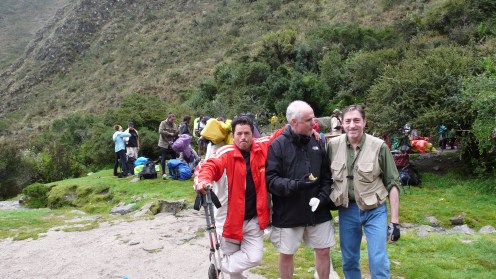
At breakfast earlier we had enjoyed a really healthy fruit and yogurt-cereal rich meal together. The cook from Llama Path, Cecilio, had outdone himself again! The coca tea he served us was inviting and refreshing, especially with a small spoonful of sugar mixed in. I made sure Chris had the bag of coca leaves we had bought at Kilomter 82. That extra “help” would be needed. Certainly, everyone knew what was ahead. No one talked much about it. There was a kind of shadow hovering over us all. It felt like the Ringwraiths were circling high overhead! Now it was time to do this thing! Off we went to the official checkpoint, where our passports were stamped and our tickets were checked before we could proceed to the trail up to the pass. It was a foreshadowing of things to come that the simple passage up to and through the checkpoint was a strenuous hike up a steep muddy trail from our campsite!
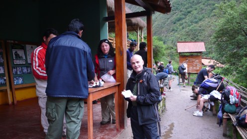
Chris at Wayllabamba checkpoint….
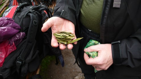
Coca leaf, to chew on through the hardest part of the hike ahead.

The graphic map of the Inca Trail….
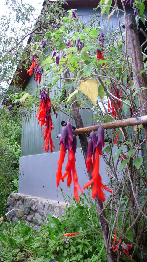
A beautiful, strange flower growing next to a Checkpoint hut…
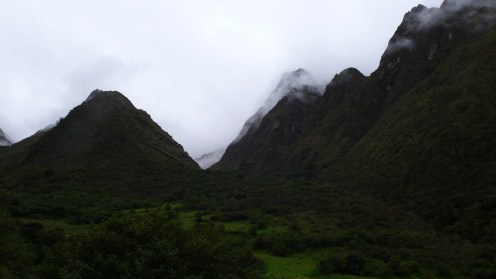
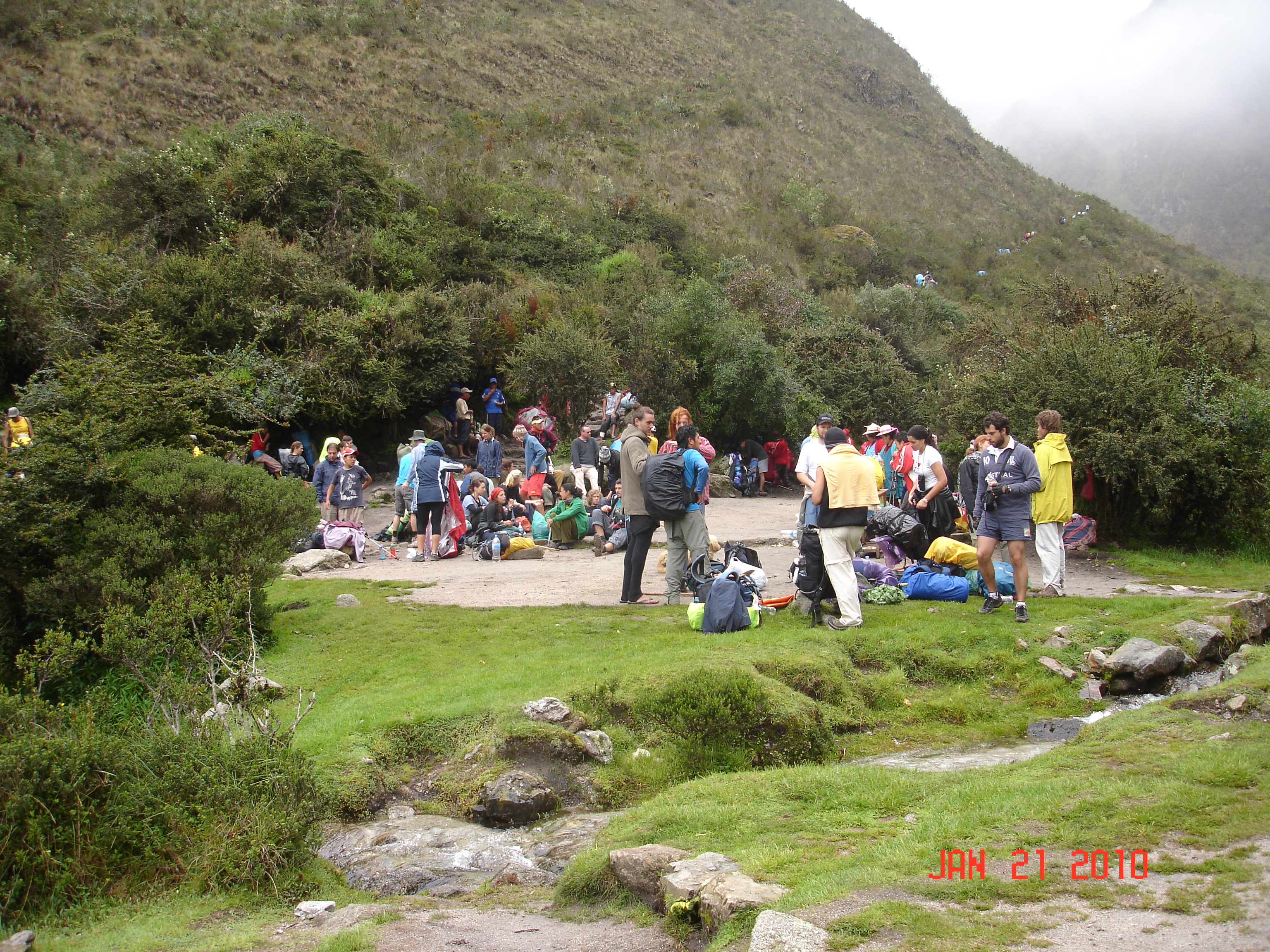
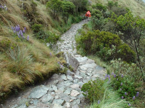
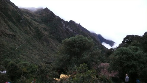
At least the weather cooperated this second morning. The day was starting beautifully, broken clouds and patches of blue sky were chasing each other through the Andes mountain peaks as we caught our wind and moved into the task at hand, step by steady step. We were ascending a narrow muddy path running at right angles out of the valley of Wayllabamba. Ahead, a branching valley where the trail veers left and then crosses over and heads right and up once a stream is crossed. The barest hint of the wide open, high valley called Llulluchapampa is visible way up ahead.

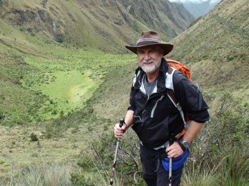
Jim steadily attacking the trail out of Wayllabamba…
…and the view of the trail ahead…..
Here’s where it started to become a routine. Once you knew that, and adjusted your pace and breathing accordingly, the ascent was manageable. Some young people tried to prove how virile they were, and it caught up with them. Some of our fellow pilgrims were just not in good shape at all, it probably wouldn’t have mattered. Others, had enough life experience to know their best way to pace, and those just kept slogging onwards. We were in that group. Not quick like hare, but steady and reliable like tortoises. Of course, Mr. Coca helped…a lot!
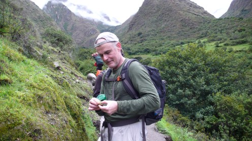
Chris “packing and rolling” a fresh cud of coca….
I kept thinking about that stupid Skoal commercial on TV years ago…”…just a leetle peench ‘tween ma’ cheek and gum…“! Well, this was better than Skoal any day! Here’s to the magical coca bush…the fuel of the Inca!

Dave, Julian and Chris and the view back down the valley where we had come…
The pilgrim’s tales really began on this stretch of trail, for everyone needed a break regularly…and so, regular conversations could ensue with those who we had just nodded to or grunted at the day before. Toby from Sydney was one of the first whose acquaintance we made. The lad seemed ill-attired for the trek, and he readily admitted a love of spirits (not those heavenly and ethereal beings) had him chasing skirts through the bars of South America for the past few months of Holiday from school in Sydney. He now realized that wasn’t the best of training for such a trek as this!
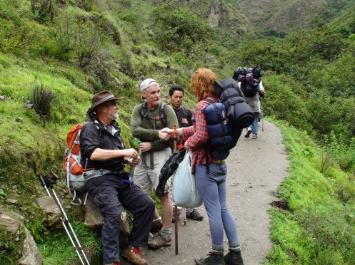
Dave and Chris meeting and visiting with Toby for the first time….

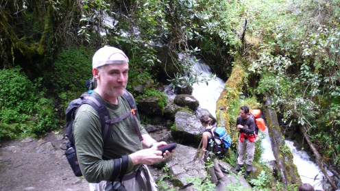
A cool “rainforest” look to the trail begins as we approach the stream…

Chris demonstrating careful footwork….
…if we could read your mind, Chris!
And so, the narrative gets a little monotonous: Steep trail, short steps, inhale three short times, exhale deeply…repeat. Flat trail, breath through the nose, slowly and steadily. Meet your fellow trekkers for they have interesting stories to tell. Don’t get a trek pole in the eye from the guy in front! Pause often to let the heart slow down, but not too long to let the legs tighten up. Never think that you can stop. The end is never in sight, it is just another rise. Drink water. Smile a lot, even if you don’t feel friendly!

Appreciate the beauty of the trail….even when it hurts!

Stepping aside for a short rest….and to appreciate the drama of the place!


Rest and snack at Llulluchapampa…the beautiful valley below the final push to the pass!

Julian and Chris at the break stop at Llulluchapampa
But, the break had to end and the final push up the long valley to the top of Dead Woman’s Pass had to continue! One tradition had to be honored: the taking of a stone to the top of the pass and placing it on a high spot with a wish for some special blessing. Off we go….

Dave and the Llulluchapampa Valley below….
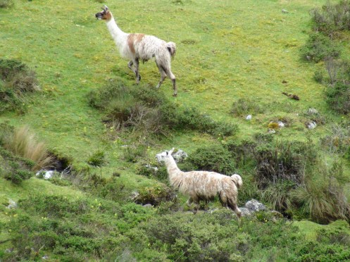
Llamas grazing in the valley as we head up to the pass.
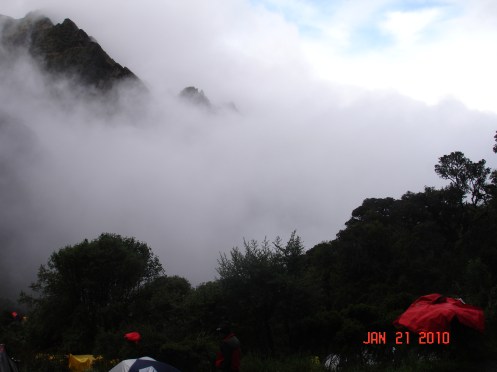
Another two hours of slow, steady steps, occasional rests and short chopped conversations…the altitude is now over 12,500 feet (3,800 meters) and the air is very rarified. A misty cloud hangs over the pass, hiding any detail that we can discern…conversation almost stops as the pilgrims focus on just moving up hill. Pain can be felt in the deep recesses of the chest and back of the thighs. Its a never-ending stair climber! Then…above, a cry and some ghostly images….
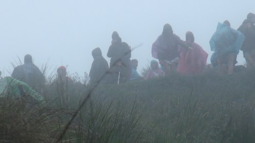
Fellow travelers await us on the high pass through the Andes!

Multhauf made the Pass first, and encouraged us to push on from above!

The INHL Team at the top of Warmiwanusca Pass (13,779 feet or 4,198 meters) in a driving rainstorm!
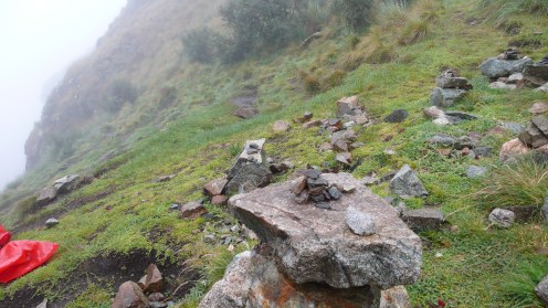
My Wishing Stone (the light grey, dry one) on its perch at the top of Warmiwanusca Pass!
It’s about an hour and a half’s quick plunge down the back side of Warmiwanusca Pass to the second night’s camp site at the Pacaymayu River. For a slow hiker, maybe two hours. If you were injured or sick from the ascent to the pass, figure a hard two and a half hours down the other side. The trail is a staircase, paved with medium sized, rough granite stones…the same ones laid by the Inca six hundred years ago! For us, it was driving cold rain…in the face…as we pushed downwards to the camp. The trail was excellently defined, and the terrain was beautiful. When not a flat, sloping trail, the makers built stone staircases able to survive the elements of time. Pacaymayu Camp is at 11,700 feet (3,580 meters) so it affords the possibility of a good night’s rest.
The Inca Trail paved with granite stones on the back side of Dead Woman’s Pass

Waterfalls plunging into the Pacaymayu Gorge

Wild indigenous potato blooming next to the Pacaymayu River camp!
Arriving at the camp, which was set up on a series of benched earthen terraces with good views around, I could not help thinking about afternoon tea! The hike down from Warmiwanusca Pass in the driving rain had been quick, but hard on the legs. The hour and a half to travel the three and a half kilometers seemed like an express train compared with the slow progress on the ascent! All the way down to Pacaymayu, the huge waterfalls on my left danced and swayed into the valley from their high perches. We ran into Toby again on the way down, stumbling and bewildered, he admitted to being slightly disoriented after the effort of the hike. A few minutes conversation assured me that if he would take his time and be careful on those irregular Incan steps, he would make camp soon and recover.
Here, right by our camp, Jim discovers wild potato blooming alongside the most significant water source in these higher elevations: the Pacaymayu River! Could these plants be heirs to the ancient Incan cultivation of this tuber somewhere nearby? Are there undiscovered agricultural terraces amongst the wilds of this high valley? My imagination stirred. The potato originally came from Peru and the Andean highlands stretching to Chile. It was an essential food crop for the indigenous people of this land long, long before the Spaniards took it back to introduce it to Europe with their other prizes. Of course, today, potatoes are one of the world’s most important sources of starch and carbohydrates. The 3,000-odd varieties of potato found in Peru are a testament to the profound significance this food source has played in South American culture.

Swollen streams and slippery old wooden bridges….
The Red Army had done its job well, and our camp was set up in the muddy, rain soaked high jungle as best one could expect…even having harvested great quantities of long grasses to spread in the mud puddles so the footing wasn’t so squishy. Cecilio was hard at work in the “kitchen” portion of the mess tent, the table was nicely laid out for us on the dining side. Evening approached, and tired bones ache for some rest.

Jim and Chris discuss the incredible day’s ascent and descent of Dead Woman’s Pass with our guide, Julian Perez (better known as “Gallo”)
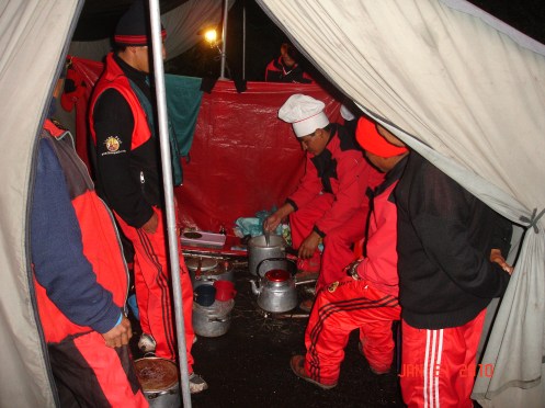
Our chef, Cecilio “Primero”, at work with his magic in the kitchen!
Evening approaches the Pacaymayu Camp…
….and misty clouds from the Urubamba River Valley far below roll in to wrap us in their soft blanket for the night.
…Vincit!

How much is shipping to Canada?
hey this blog is great. I’m glad I came by this blog. Maybe I can contribute in the near future. PM ME on Yahoo AmandaLovesYou702
Thank you…I still can’t get this trip out of my head! David
Hey mate, greetz from the UK !
ok..this one goes on my to do list! great blog! I was dissapointed that the story ended..it is like a good book that you want to keep on reading.the only thing:why is it called dead womans pass?
greets from the netherlands
Thank you for the compliment. There is much more to the story. Here’s a link to the next “chapter” https://davetzold.wordpress.com/2010/01/30/inca-trail-day-three-the-secret-of-the-inca-cross/ , then after you’ve enjoyed that story, click on the “Inca Trail to Machu Picchu 2010” link in the “Category Cloud” box in the right margin, it takes you to ALL my chapters about the expedition to the Inca Trail. DFE